The lost kingdom of Lo
Papa has never really had a fascination for travel. More of an explore your backyard kind of guy. I swear he's hiked, run or climbed most of the trails in a 20km radius from our home. That's a lot of trails for Chamonix. That rule changed when we visited Nepal in early 2021. More than a month of climbing and exploration had him longing for more. Mum has always been the holiday planner, but this was a job (risk?) he was willing to take on.
Some of Nepal is far from off the beaten track for most western travellers. The Everest Base Camp and Annapurna Circuit treks host thousands of hikers nearly year-round. For papa, that wasn't the plan. His plan was quieter, more peaceful, and unique. His plan was Upper Mustang.
Upper Mustang is a Nepali district just north of Pokhara, where the Kali Gandaki river flows from the Tibetan plateau down to the lowlands. It's a gap in the Himalayan chain that's acted as a trade route for centuries. Signs of travellers predate the 8th century. We hiked the Upper Mustang trek: ten days at an average altitude of 3500m, with many climbs hitting above 4000m. Here are some of my thoughts.
Remote yet developed
Upper Mustang feels like stepping into another world, yet surprisingly connected. Gravel roads wind through ancient valleys, connecting villages that have traded with Tibet for over a millennium. You'll find solar panels, high speed wifi and instagram scrolling locals next to centuries-old monasteries. Globalisation in action.
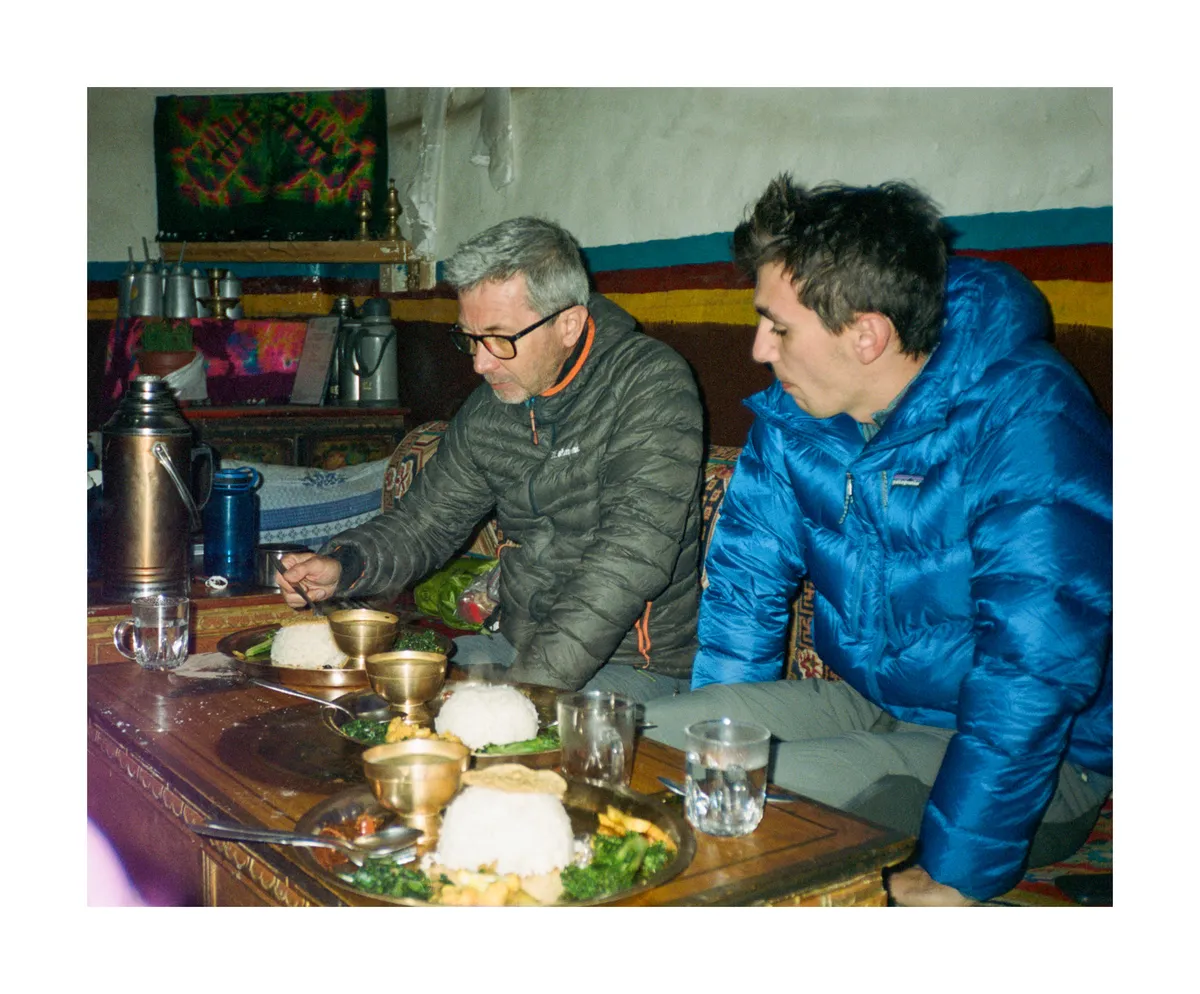
Food
- Dal bhat (dal bhat power 24 hour) - the local saying that became our mantra. Rice, lentils, vegetables, and pickles that somehow fuel you through long days at altitude
- Thukpa - hearty noodle soup that rehydrates you after a day of hiking at altitude
- Raski - moonshine (in this case made from millet) that locals shared around the fire or after a meal. For us, served out of a plastic jug by our guide with a grin on his face.
- Buckwheat pancakes and yak cheese. Buckwheat is the only grain they can grow at this altitude. A bit too dry to my liking.
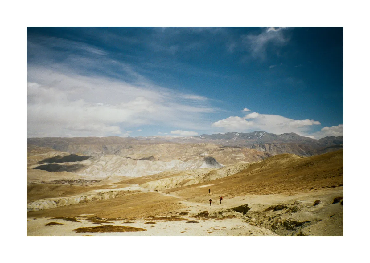
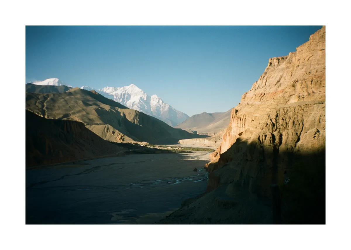
Landscape
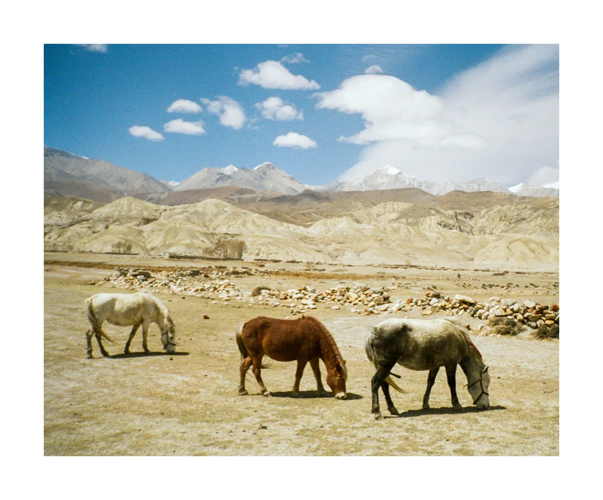
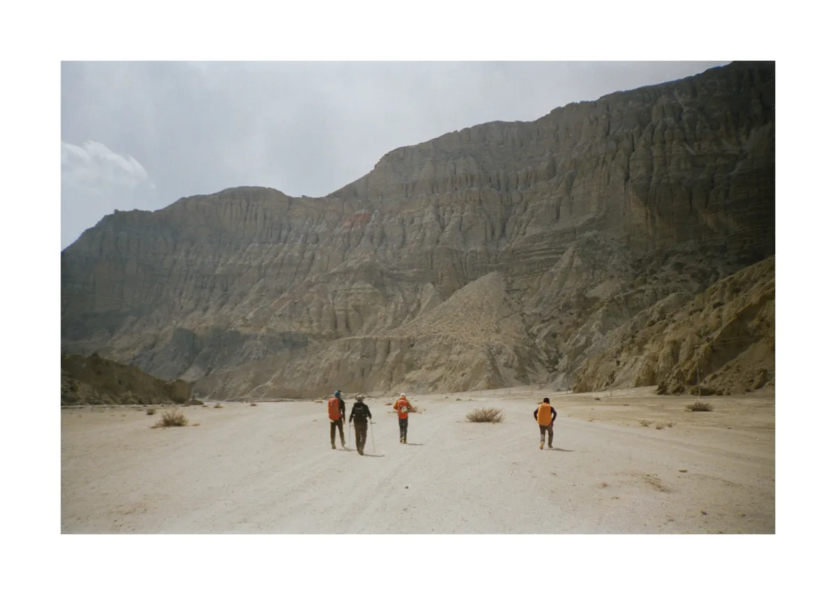
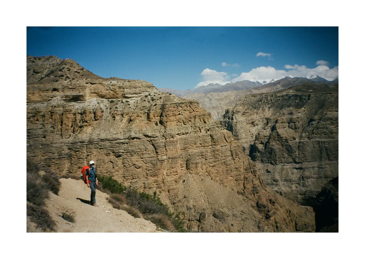
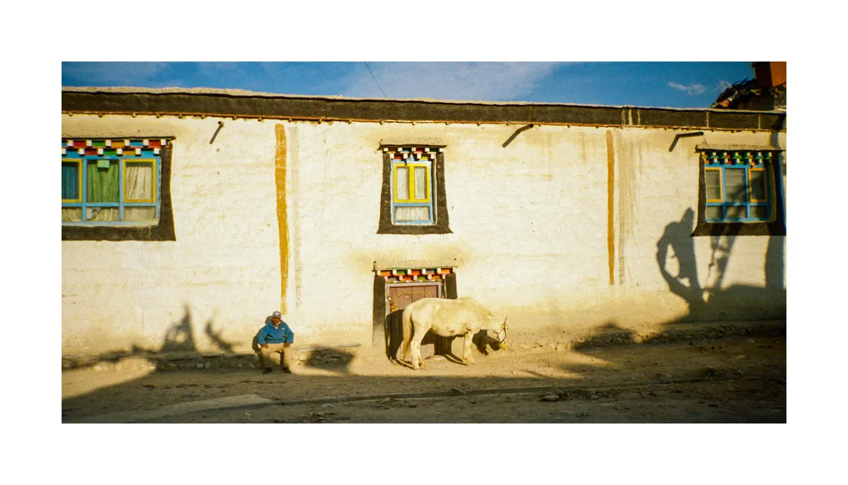
The contrast hits you immediately. Dry, almost desert-like terrain carved by deep canyons and dotted with ancient temples. Red cliffs rise like monuments, hiding cave complexes that monks inhabited centuries ago. High altitude passes connect deep river beds, with the Kali Gandaki River cutting its ancient path through the mountains. Tiny villages emerge from the landscape with red rock buildings and painted, colorful stupas. Grazing horses dot the vast plains between settlements looking hard some greenery to munch on. Gravel roads snake through valleys where prayer flags flutter against impossibly blue skies. When people think Nepal, they think green pine forests in dense valleys leading up to huge glaciers and summits, but this isn't that Nepal - geographically, it's more like the Tibetan plateau: dry, windswept, and lunar.
History
For over 2,000 years, communities in Upper Mustang have carved elaborate "sky caves" into cliffsides—evolving from ancient burial sites (1000 BCE) to medieval fortress cities to Buddhist monasteries with stunning 13th-century paintings. These early inhabitants were already connected to international trade networks, burying their dead with gold masks and Chinese silk textiles before London was even a proper city. You can see these caves explored in this fascinating 3-part YouTube series following archaeologists rappelling into thousand-year-old burial chambers.
All this wealth came from salt. For centuries, Upper Mustang controlled the most direct route between Tibet and the Indian plains, with Lo kings getting rich by taxing yak caravans that hauled Tibetan salt south while rice and spices went north—essentially a medieval toll booth with spectacular views.
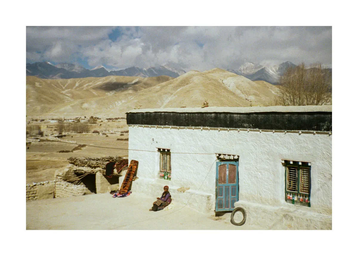
The party ended abruptly in the 1950s when China took over Tibet and built new highways, while cheap Indian salt reached Nepal by road. Almost overnight, Upper Mustang went from international trade hub to forgotten backwater. The Kingdom of Lo maintained independence until 2008, and today villages like Lo Manthang still feel like time travel—though increasingly shaped by trekking tourism rather than ancient trade routes.
Walking through villages like Lo Manthang still feels like time travel, save for the occasional motorbike rumbling past on gravel roads. However, the town seems to be changing, increasingly catering to the groups of flat white craving hikers strolling through.
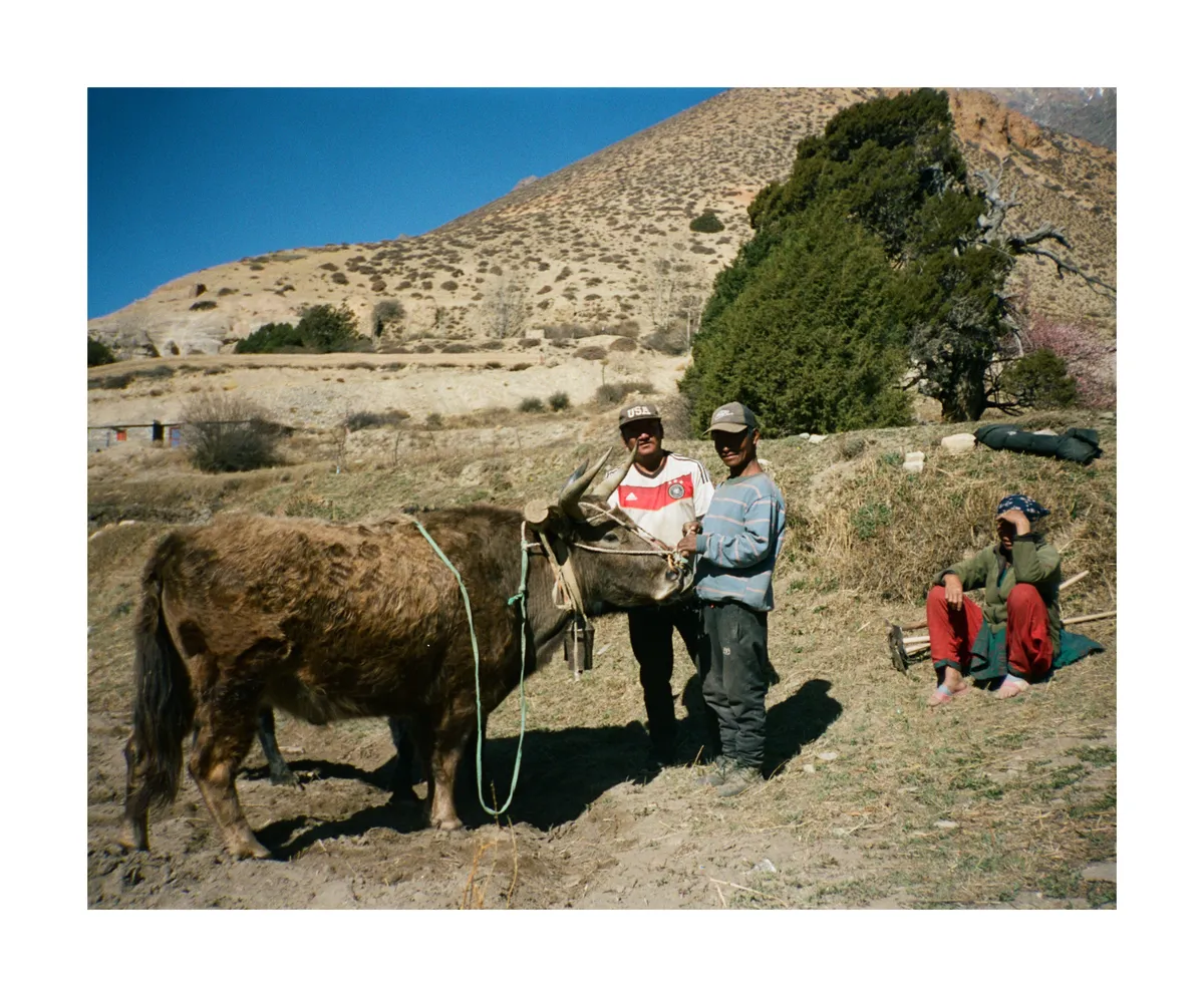
People
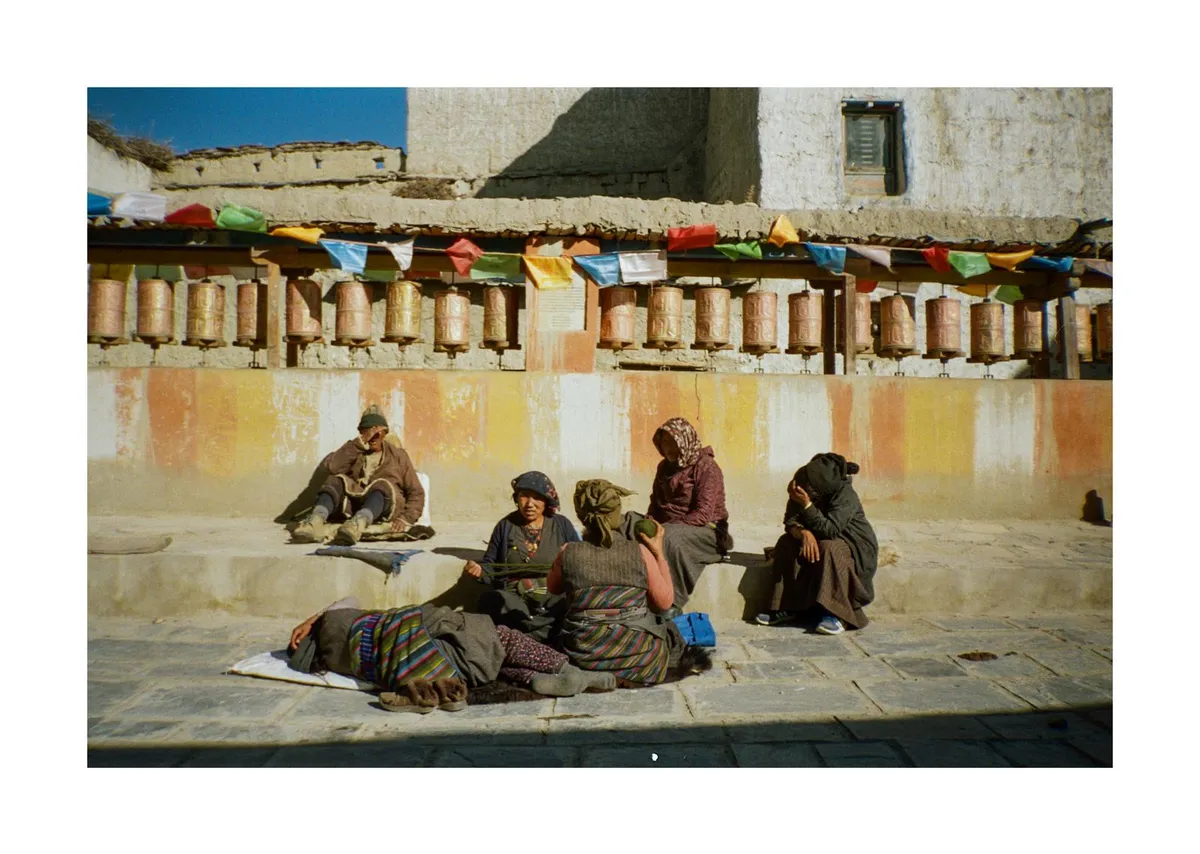
The Lopa people are incredibly kind and welcoming, greeting every encounter with "Namaste" and wide smiles. Most speak Tibetan rather than Nepalin-a reminder that these valleys have always looked north toward Tibet rather than south to Kathmandu.
What amazed me was their resourcefulness. Living at 3,900 meters (Lo Manthang) where resources are scarce, they've mastered making abundance from very little. Families have converted their homes into homestays, cooking elaborate meals from their own kitchens with whatever they have—yak cheese, buckwheat flour, dried vegetables from last harvest. The extremes here are harsh: blazing hot days followed by freezing nights. Yet the Lopa seem content. Lots of smiles, happy children, easy conversation, and genuine curiosity about outsiders like us.
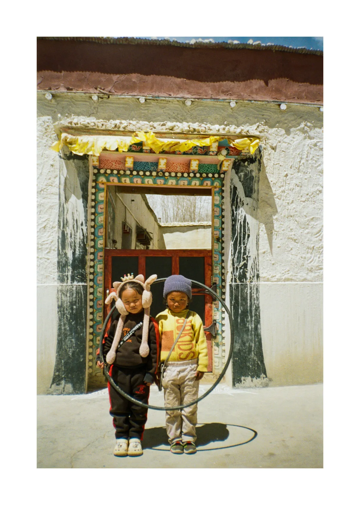
There's change happening too. Young people still leave for the cities, but many are returning. There's a growing realization that tourism will transform this place. The same families who watched ancient trade routes disappear in the 1950s now see trekkers as their new lifeline, opening homes and kitchens on their own terms.
After ten days in this otherworldly landscape, I got it. Papa's obsession with Nepal suddenly made sense.